 vesseltracker.com
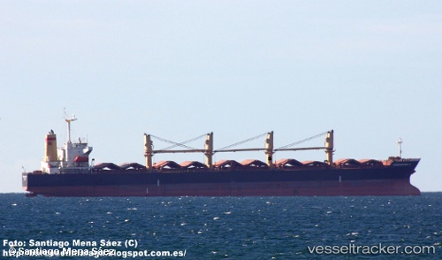
Vessel BRIGHT WORLD IMO: 9181041, MMSI: 355300000
UTC, 16.99393, 67.19732, course: 134, speed: 11.1
UTC, 16.80085, 67.41502, course: 133, speed: 11.4
2026-02-05 00:02:15 UTC, 16.51203, 67.73796, course: 131, speed: 11
Live AIS position:
UTC. 302 nm SW of Veraval),
updated 2026-02-05 00:02:15 UTC.
Find the position of the vessel BRIGHT WORLD on the map. The latter are known coordinates and path.
marine traffic ship tracker show on live map
The current position of vessel BRIGHT WORLD is 16.51203 lat / 67.73796 lng. Updated: 2026-02-05 00:02:15 UTCDetails:
Last coordinates of the vessel:
UTC, 17.27993, 66.87434, course: 132, speed: 11.2UTC, 16.99393, 67.19732, course: 134, speed: 11.1
UTC, 16.80085, 67.41502, course: 133, speed: 11.4
2026-02-05 00:02:15 UTC, 16.51203, 67.73796, course: 131, speed: 11